
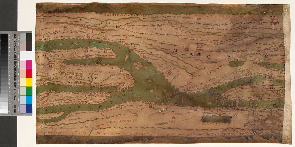
The Tabula Peutingeriana is the sole preserved map of the “cursus publicus”, the public road system of the late Roman Empire. This medieval copy from the late 12th century provides insights into the management and economy of a great ancient empire.
The Tabula Peutingeriana is a medieval copy (cod. 324) of an ancient scroll, the original of which has been lost, and is preserved in 11 segments. It depicts the Roman empire, its provinces and even regions that extend to China. Therefore, it illustrates not only the Roman Empire, but also regions outside its rule.
The Tabula Peutingeriana does not correspond to any traditional geographical map; with its west-east orientation and missing representations of oceans, it is limited to reproducing functional networks. This administrative aspect provides valuable information about the management and economy of the Roman Empire and its connections to other regions and empires.

Global significance
The medieval copy of the Tabula Peutingeriana also plays an important role in the present because it is the only preserved map of the Roman traffic system. It can be used as an orientation guide in order to locate and preserve Roman streets and archaeological sites and therefore contributes to the conservation of Roman heritage in Europe. A modern example that corresponds to this concept of reproducing functional networks are the images of European and worldwide underground networks.


